Skip to main content
Contact Us
HR/Jobs
Most Recent Board Agenda
Lead & Copper Service Line Reporting
Search:
Search
Toggle navigation
About Us
Our Story
Our History
Our Mission
Board of Directors
Meetings & Minutes
Board Division Map
Redistricting 2021-2022
Transparency
Management
Human Resources
Financial & District Documents
Public Records Request
Doing Business with NID
Customer Service
Update Account Information
Customer Service & Payment Information
Payment Portal
Start/Stop Water Service
Getting Irrigation Water
Drinking Water Outages
Irrigation Water Outages
Water Emergency
Current Water Rates
Water Rate Adjustments
Low Income Rate Assistance Program
Water
About your Water
Canal Safety
Conservation & Drought Information
Drought Information
Water Use Efficiency
Conservation Resources
Demonstration Garden
Mulch Magic Give Away
Incentives & Rebates
Seminars and Workshops
Cross Connection Control Program
Development Standards & Specifications
District Facilitated Waterline Extensions
Fire Hydrant Locator
Fire Preparedness
Planning Efforts
Water Rate Planning - Cost of Service
Yuba-Bear - FERC Licensing
Water Planning Projections
Agricultural & Urban Water Management Plans
Surface Water Treatment - Watershed Sanitary Survey
NID Capacity Charge Update
Nevada County Hazard Mitigation Plan
Placer County Multi-Jurisdictional Hazard Mitigation Plan - 2026
Projects
Projects Underway
Report Water Waste
Right of Way & Encroachments
River & Reservoir Data
Vegetation Control
Water Quality
Stewardship
Forest Health and Fire Safety
Meadow Restoration
Fish Passage Project
Long Term Tree Health and Canopy Cover Assessment
Quagga and Zebra Mussel Prevention and Monitoring Program
Combie Reservoir Sediment & Mercury Removal Project
Recreation
Campground Information
Golden Mussels Prevention Program
Scotts Flat Lake
Rollins Lake
Jackson Meadows Lake
Aspen, Faucherie, and Silvertip Group Campground Reservations
River & Lake Hourly Data
Combie - Dock Encroachment Permit
Hydropower
About Hydropower
Yuba-Bear Project
Dam Safety
News & Info
News Releases
GM's Monthly Newsletter
Water Infrastructure Library
105 Years Forward -- NID anniversary
History Book
Bay-Delta Water Plan Update
Feature Stories
Damaged infrastructure impacts NID water supply
Snow Surveys
Blog
Videos - YouTube
Resources & Links
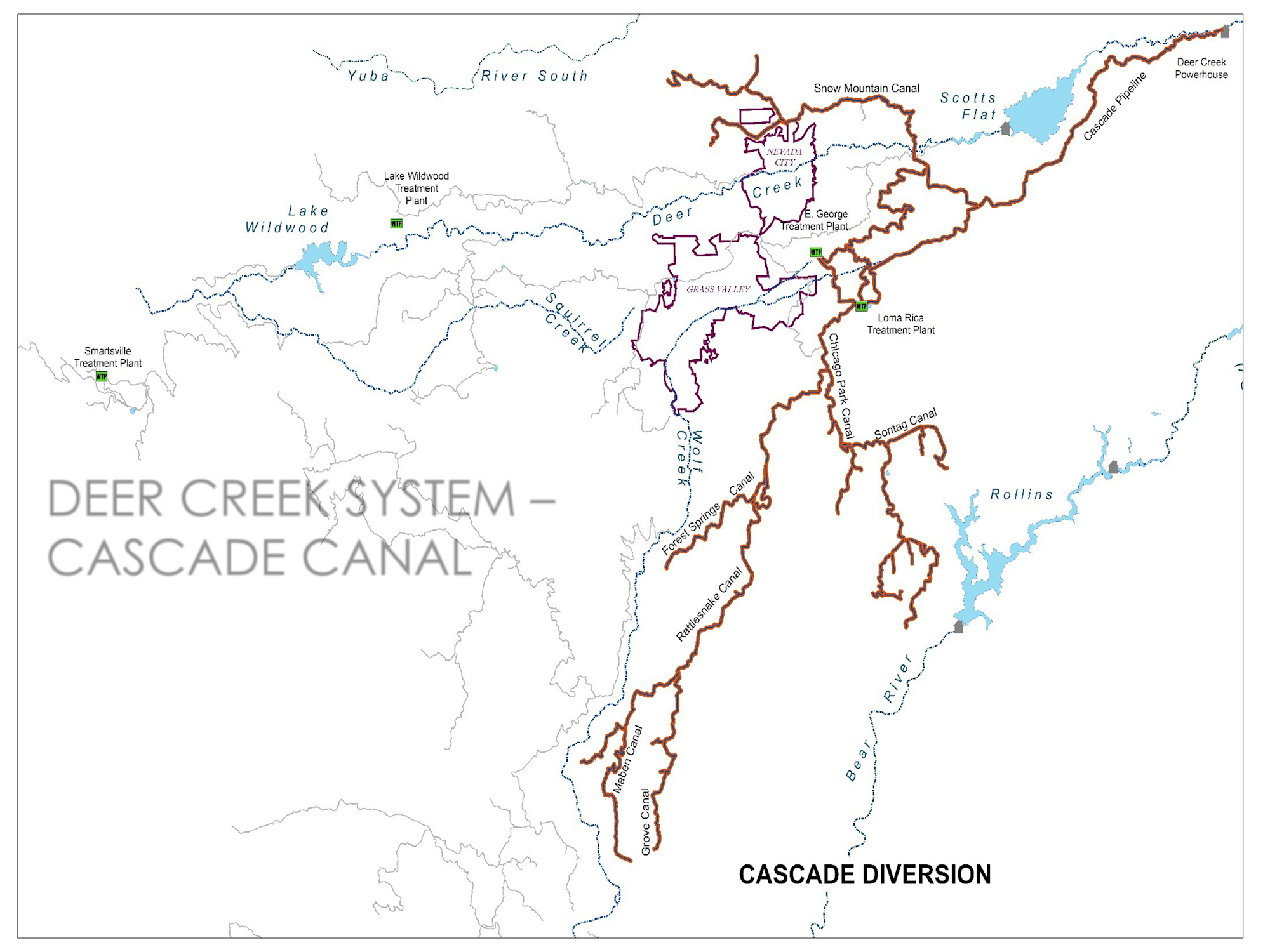
Cascade Canal System Diversion
×
Sign up for updates from Nevada Irrigation District
Thanks for signing up!
There was an error saving your request. Please make sure you entered a valid email.
Enter your email address:
News and Alerts
All Meeting Notices - Board and Committee
Plan for Water
Centennial Water Supply
NID Water Blog
Projects Underway
Damaged infrastructure impacts NID: Summer 2024 updates
Sign Up
Join our mailing list
×
Search results
Search
Search