
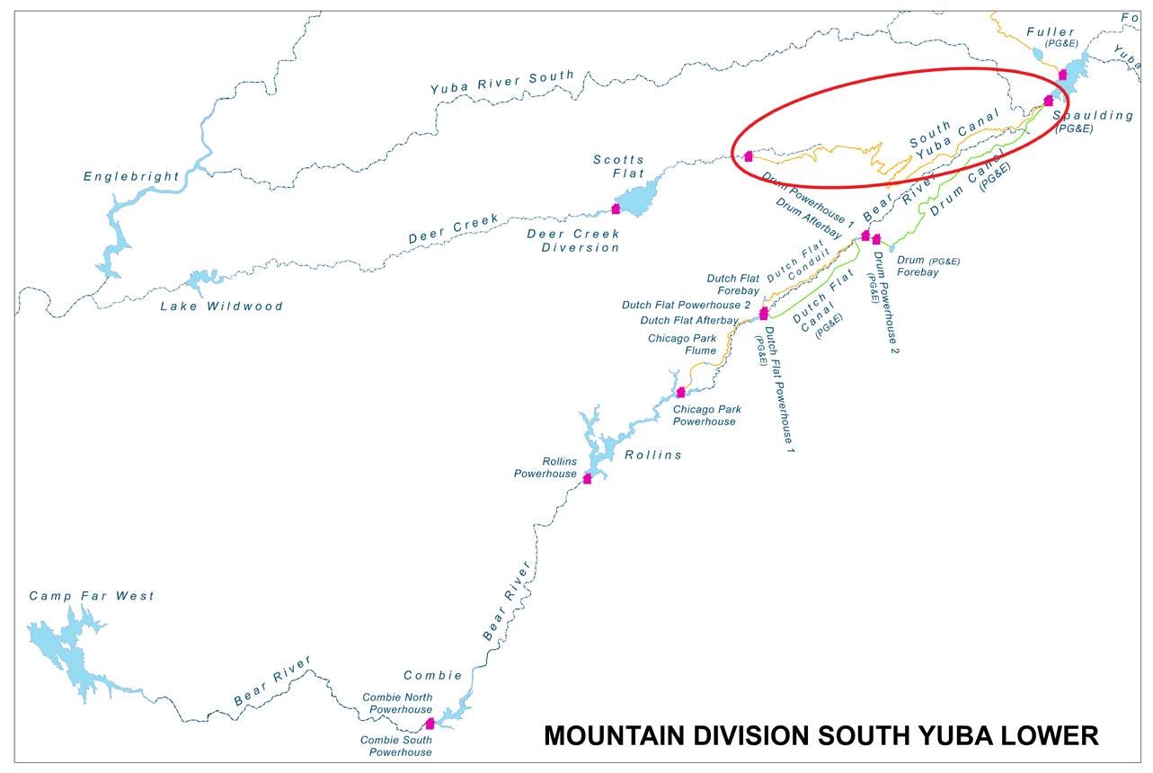
South Yuba Canal

The South Yuba Canal is NID’s primary water conveyance that moves water from the mountain headwaters down into the Deer Creek watershed where it becomes the primary water supply for NID’s Cascade Canal System.
This important infrastructure transports water to just-above Scotts Flat Lake and plays a key role in keeping the reservoir full.
Additionally, it supplies the water for the cities of Grass Valley and Nevada City.
The canal is part of the Drum-Spaulding Hydro System (license issued by the Federal Energy Regulatory Commission (FERC)). The water delivered through the system is used to generate hydroelectricity for the from the Deer Creek Powerhouse, located above Scotts Flat.

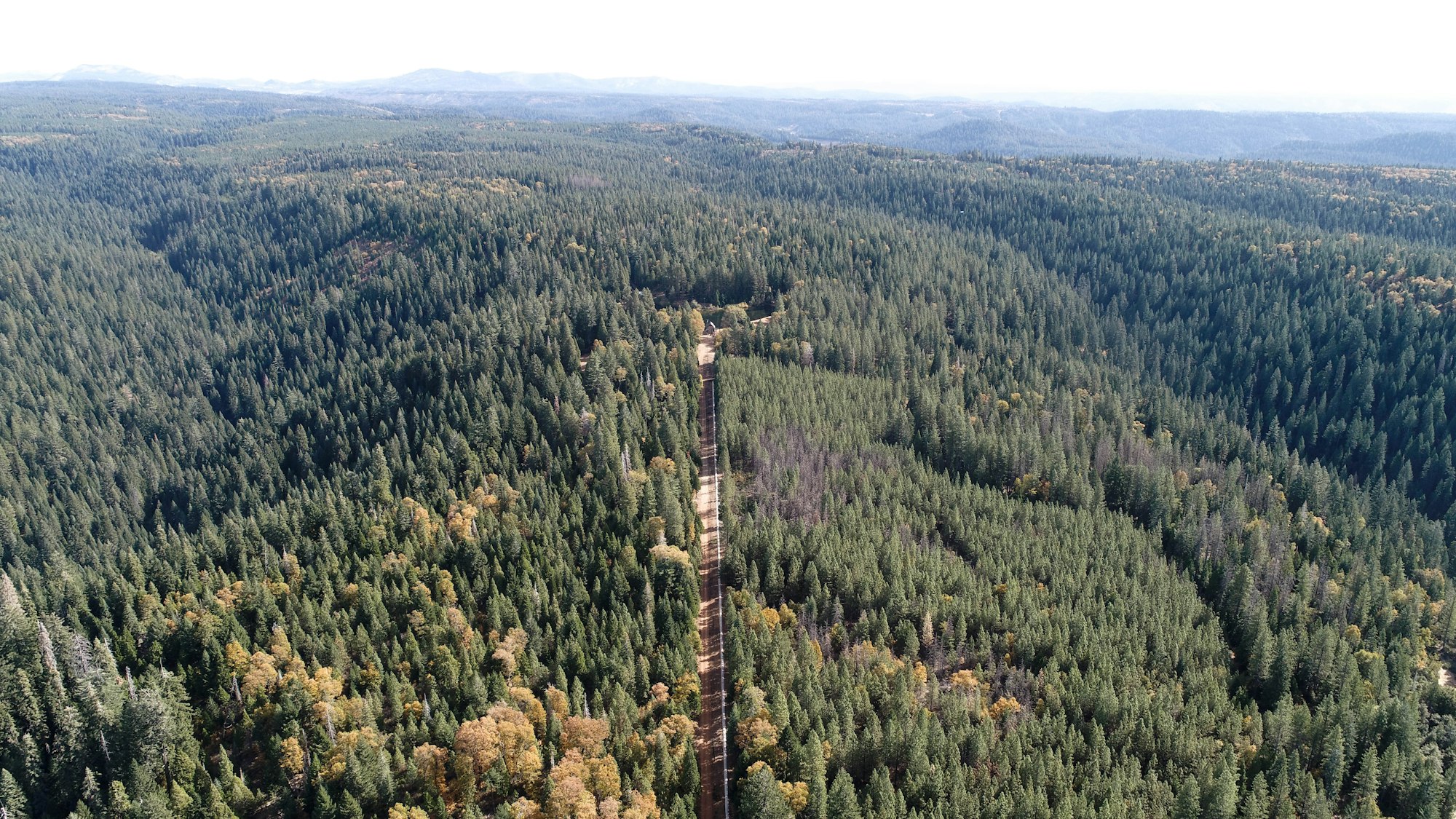
The South Yuba Canal infrastructure is approximately 19 miles long and traverses both private and National Forest lands. Approx. 11.6 miles of the system are located within the Yuba River Ranger District of the Tahoe National Forest.
The canal is an amazing, important piece of water conveyance infrastructure. It was the first major water project built in California from 1853-1857; and today, the canal remains vital for water deliveries to Nevada City and Grass Valley.
Watch the NID South Yuba Canal educational video (produced before the NID acquisition of the canal)
Related NID Infrastructure Library entries: Deer Creek Powerhouse and Cascade Canal System
HISTORY OF THE SOUTH YUBA CANAL
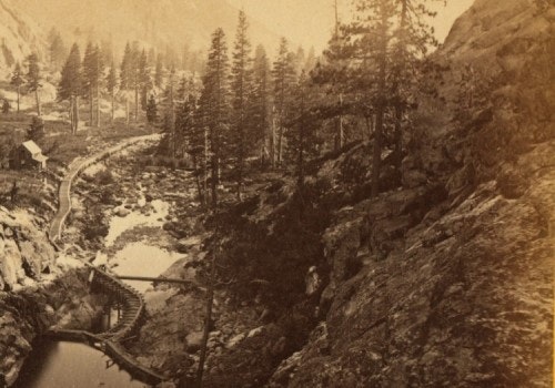
The South Yuba Canal was the first major water project built in California from 1854-1858. The original 16-mile canal channeled water tapped in the high Sierra to lower elevations, where it was used to power high-pressured water cannons used in hydraulic mining. The waterway featured nine miles of ditch, seven miles of flumes, and two tunnels that stretched more than two miles.

Construction took four years with a total cost around $600,000.
Workers faced constant challenges. Not in the least was the construction of a mile-long flume that was more than 100 feet high on a narrow shelf of a granite mountain. It was so steep that the drilling and blasting was done by men hanging over ledges on ropes.
“ … the waters enter a flume, seven miles in length, set on solid wall-rock for one and a half miles through the canon [sic] on the South Yuba, a shelf having been blasted through the solid precipice rock, in places a hundred feet high, to receive it, the workmen at first being let down from the top by means of ropes to begin the drilling and blasting,” wrote Edwin Bean in Bean’s History And Directory Of Nevada County, California, published in 1867.
EDWIN BEAN DESCRIBES THE CANAL IN DETAIL (1867):
“One of the most extensive canals of the State is that owned by the South Yuba Canal Company, taking water from the South Yuba river, and several lakes as feeders, and distributing it to Dutch Flat, in Placer county, as well as over the extensive region lying between the South Yuba and Bear River, as far down the western slope of the Sierra Nevada as Grass Valley.”
“The main canal of this company is sixteen miles in length, commencing on the South Yuba and passing through a tunnel sixty feet in length, which cost $6,000, the waters enter a flume, seven miles in length, set on solid wall-rock for one and a half miles through the canon on the South Yuba, a shelf having been blasted through the solid precipice rock, in places a hundred feet high, to receive it, the workmen at first being let down from the top by means of ropes to begin the drilling and blasting.
Another tunnel, 3,800 feet long, at the head of Deer Creek, enables the waters of the South Yuba to mingle with those of Deer Creek. This tunnel was finished at a cost of $112,000. The capacity of the canal is 8,500 running inches, miner's measure, its size is six feet wide by five deep, and work commenced upon it in April, 1853, ending October, 1858.
The cost of the main canal and tunnels was not far from $600,000.
A branch ditch runs from the lower end of the grand tunnel, eighteen miles, to Chalk Bluff, Red Dog and You Bet. From the same point another branch runs to Omega, Alpha, Gold Hill and Blue Tent, also eighteen miles in length; while the supply for Nevada and Grass Valley is thrown into Deer Creek and taken out six miles below to fill the Cascade ditch, leading to Quaker Hill and Scotch Flat, and going farther on supplies Gold Flat and Grass Valley.”
