NID celebrates 104 years
From Sierra streams to greener dreams
On August 5, 1921, voters in Nevada County made a historic decision that would reshape the future of their communities. With a vote of 636 to 163, residents approved the formation of a local irrigation district — a pivotal step toward bringing Sierra Nevada water to the parched farms and ranches of the foothills. Just ten days later, on August 15, the Nevada Irrigation District (NID) was officially established.
To some, it may have seemed like just another election. But for the families working the land, it marked the dawn of a new era — one no longer driven by gold or timber, but by the life-sustaining promise of water.
The formation of NID brought more than infrastructure. It sparked growth in the local agricultural industry, strengthened the region’s economy, and laid the foundation for a legacy of resilience and innovation. It was the beginning of a forwardlooking movement — one that helped shape the vibrant, thriving communities we know today.
Read the full feature article about the campaign to form the District and get the water flowing.
Photos:
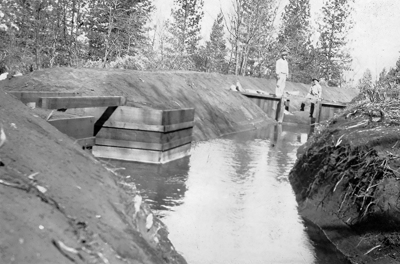
(Top right) A 1927 photo of the Dressler Canal, part of the Chicago Park system. On the left, the gate below the outlet directs water into the Rattlesnake Canal to the lower right, as well as the Chicago Park Canal beyond the workers.
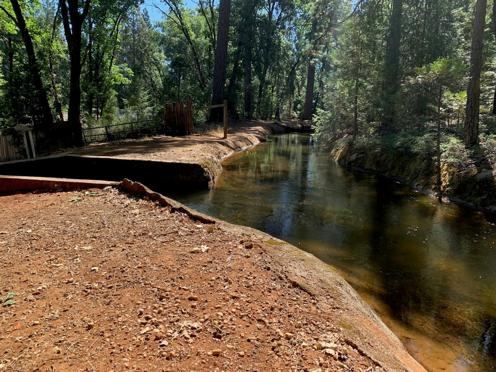
(Upper right) A photo taken in late July, 2025, shows that not much has changed since those early days. It’s a testament to the enduring design and function of the system.
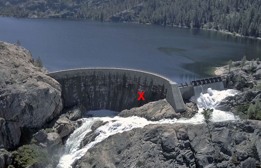
(Below) In 1926, NID’s first Engineer, Fred Tibbetts, surveys the Bowman Dam Spillway, located about 40 miles northeast of Nevada City. His work marked the beginning of a major effort to reconstruct and enlarge the dam. (Bottom) The Bowman South Arch today. Tibbetts once stood about where the red “X” is marked. The dam was raised, and the spillway he faced in 1926 was relocated to the right.